Showing posts with label washington. Show all posts

Thursday, September 4, 2014

Mt Baker National Recreation Area - Railroad Grade & Park Butte Backpacking

Mt Baker National Recreation Area

After having just finished a five day backpack trip through the Glacier Peak Wilderness, we decided to take a shorter and cooler backpacking trip on the west side of the Cascade Mountain Range.  After driving over and spending the night at Baker Lake, we woke up in the morning, packed and headed up to the trailhead.

Railroad Grade and Park Butte Trails

Arriving early at the trailhead on a Friday morning, we were lucky enough to beat the weekend crowds.  As we hiked up toward where we would set up camp, the sun rose higher along with the heat and humidity.  Though not as hot as it was on the east side of the Cascades, the humidity made it feel just as warm and sticky.

After passing the trail junction for Railroad Grade and Park Butte, we got our first good views of Mt Baker.  It was beautiful, majestic and inviting.  A few pictures and we continued on to Cathedral Pass where we put up base camp for the night.  Not a bad hike, about 1300 feet of elevation gain.

First views of Mt Baker from the Railroad Grade / Park Butte trails.
Once arriving at Cathedral Pass and setting up camp, we decided to explore.  We were happy to drop the heaviness of the packs and carry a lighter pack for the day with only the essentials that we needed.  First we headed back down to the junction of the Railroad Grade and Park Butte trails and headed up toward the climbers camp on Mt Baker via the Railroad Grade trail.  This trail runs along the top of a ridge line toward Mt Baker and its glaciers.  It is exposed and provided us some good exposure in the sun (ie, make sure to wear sunblock) and great views of Mt Baker and the surrounding area.  We were even able to see Glacier Peak in the distance where we had just spent five days backpacking.

View looking down the Railroad Grade Trail and the Cascades in the distance.

Mt Baker from just above Climbers Camp on the Railroad Grade Trail
Taking a break to take in the views once we reached the climber's camp, we decided to head up further on the trail.  At our high point we were at an elevation of 5,990 ft on Mt Baker (10,781 ft).  If only we had time and the gear to climb to the top.  But after spending time on Mt. Baker we decided to head back down toward camp.  We were hot from the heat, humidity and exposure.

At camp we took a break, finished setting up camp and built a snowman, which in this heat didn't last very long.  But when you have snow and time for a break - what else is one to do?

Building a snowman at Cathedral Pass @ Mt Baker
Building a snowman at Cathedral Pass @ Mt Baker
After dinner we decided to take a hike and head up to Park Butte.  Park Butte is in the Mount Baker Wilderness Area and is a restored 1933 fire lookout.  Upon arriving at the top we explored the fire lookout and took in the views all around us.  

Park Butte Fire Lookout on top of the ridge @ Mt Baker Wilderness Area
Park Butte Fire Lookout on top of the ridge

View out from Park Butte fire lookout at Mt Baker

View from Park Butte fire lookout over toward the storms @ Mt Baker Wilderness Area
View from Park Butte fire lookout over toward the storms 

On the day we headed up, storms rolled in to the south and west.  It was pretty interesting to watch the sheets of rain move through to the south of us.  On our way back down to camp, we took time to wander around and take a look in the pools for reflections.  We ended up with some pretty good shots of Mt Baker.

Reflecting pool with Mt Baker in the background
We finally decided to head back down toward camp for the night.  As we arrived in camp, the sun started to set and provided us with some great views over the peaks in the distance.  

Sunsetting from Mt Baker National Recreation Area
As the sun set, it was time to end another great day in the Cascades.  Tomorrow we would wake up, pack up and head out.  Another trip comes to a close.  I felt refreshed.

"Keep close to Nature's heart... and break clear away, once in a while, and climb a mountain or spend a week in the woods.  Wash your spirit clean."  John Muir


Monday, September 1, 2014

Glacier Peak Wilderness Backpacking - Spider Gap - Buck Creek Pass Loop

Glacier Peak Wilderness

Glacier Peak Wilderness holds the Northern Cascades only wilderness volcano.  And in this year when we celebrate the 50th Anniversary of the Wilderness Act, it was a perfect time to go into the remote wilderness area and explore.  No we didn't climb it, but we did spend 5 days at the end of July backpacking through the majestic beauty that surrounds it.

With the late snow that came in this year and the heat that came with the end of July, we were in for a treat.

Day 1 - Trinity Trailhead 

We started the day in Spokane, WA and drove to the Trinity Trailhead.  After parking the car here, we had a 3 mile hike up to the Spider Meadow trailhead.  I was thankful once those three miles were over and we were able to head into the woods and shade.  The goal was to hike to Spider Meadow, but after another couple of miles, the heat and lack of sleep took its toll on us.  We found a camp spot in the woods and decided to call it a day.  As we finished dinner and settled in - we had our first of many experiences with the wildlife in the wilderness.  A female mule deer wandered into camp.  She must have enjoyed our presence as she kept coming back.

Day 2 - Spider Meadow, Spider Gap & Upper Lyman Lakes

Spider Meadow looking toward Spider Gap @ Glacier Peak Wilderness
Spider Meadow looking toward Spider Gap
Waking up to a beautiful morning in the wilderness refreshed, we packed our gear and headed to Spider Meadow and Spider Gap.  Spider Meadow still held some of its beauty of wildflowers and gave us an amazing view toward Spider Gap and the peaks around it.  We also got our first view of the many marmots we would encounter in the wilderness and more mule deer grazing in the meadow.

After hiking through the meadow we climbed the trail up to Spider Gap and finally got a view of the Spider Glacier.  All reports for this trip stated to bring an ice ax with you to climb over the glacier.  But with the heat we had on this trip, the conditions of the glacier made it so that you didn't need it.  It was an amazing 1/2 mile hike up the glacier to the top and the high point of this trip (7100 ft).  The coolness of the snow and ice of the glacier made it so the heat that was bearing down on us didn't feel so bad.  

Tip: Take time once you get to the top for a break and the opportunities to take some great photos of the glacier and the Upper Lyman Lakes area.

Spider Glacier with a view back out toward Spider Meadow @ Glacier Peak Wilderness
Spider Glacier with a view back out toward Spider Meadow

Upper Lyman Lakes from Spider Gap @ Glacier Peak Wilderness
Upper Lyman Lakes from Spider Gap
After taking a break and enjoying the views it was time to head down to the Upper Lyman Lakes area.  The hike down was fun through the soft snow until we hit the end of the snow.  At that point it turns into a scramble down loose rock.  And then you find the mosquitoes.  After another break to take some pictures of the Upper Lyman Lakes area we headed over to the other side of the bogs and where we would camp for the evening.

Lyman Glacier from Upper Lyman Lake @ Glacier Peak Wilderness
Lyman Glacier from Upper Lyman Lake
View back toward Upper Lyman Lakes, bogs and Spider Gap @ Glacier Peak Wilderness
View back toward Upper Lyman Lakes, bogs and Spider Gap
After setting up camp, we had time to wander around the area and take in the reflections in the pools of water that were all over in this area.  But with that said, we also had the pleasure of battling the mosquitoes - head nets were a necessity.

Camp in the Upper Lyman Lakes area @ Glacier Peak Wilderness
Camp in the Upper Lyman Lakes area.
Sun setting above Spider Gap @ Glacier Peak Wilderness
Sun setting above Spider Gap
Evening brought us the beauty of the sun setting in the wilderness.  And with the clouds in the sky, it was even more beautiful.

Day 3 - Upper Lyman Lakes to Miners Creek / Image Lake

Waking up to another glorious morning in the wilderness (even with the mosquitoes buzzing around), we ate breakfast and headed out to our next destination:  Miners Creek to camp and a side day trip to Image Lake. Our first obstacle of the day (besides the mosquitoes) came as we got down toward Lyman Lake and had to cross the river via a downed tree.  Now crossing a river over a downed tree is not that bad, but this one happened to be right over a rapid and falls.  If you slipped on the log it was a not a short fall or would it be a soft landing - you would probably get hurt.

Lyman Falls @ Glacier Peak Wilderness
Lyman Falls

Lyman Falls crossing @ Glacier Peak Wilderness
Lyman Falls crossing
After a quick stop to take pictures of Lyman Lake we headed up to Cloudy Pass and our connection with the Pacific Crest Trail.  Make sure to take some time once you get up on Cloudy Pass to enjoy your last view of Lyman Lake and Spider Gap.  And to take in the view of all the wildflowers in the meadow up on the pass.

Cloudy Pass looking back at Lyman Lake and Spider Gap @ Glacier Peak Wilderness
Cloudy Pass looking back at Lyman Lake and Spider Gap
Cloudy Pass wildflowers - Lupine, Heather and Paintbrush @ Glacier Peak Wilderness
Cloudy Pass wildflowers - Lupine, Heather and Paintbrush
Once over Cloudy Pass, it is a short 1 mile hike to the Suiattle Pass and then down to Miners Creek.  At Miners Creek we diverge from the Pacific Crest Trail (PCT) and set up camp across from an older Miner's Cabin. 

Miners Cabin @ Miners Creek - Image Lake Trail @ Glacier Peak Wilderness
Miners Cabin @ Miners Creek - Image Lake Trail
From here we take a 7 mile side trip to Image Lake.  This is not to be missed.  On this side trip we encountered our next adventure with a water crossing, meadows full of wildflowers and our first good views of Glacier Peak.  And of course Image Lake.  

Miners Cabin @ Miners Creek - Image Lake Trail @ Glacier Peak Wilderness
Paintbrush and wildflowers in the meadows on the trail to Image Lake
Image Lake with Glacier Peak in the background. @ Glacier Peak Wilderness
Image Lake with Glacier Peak in the background.
Marmots all over the place, this one was hiding out along the trail. @ Glacier Peak Wilderness
Marmots all over the place, this one was hiding out along the trail.

Falls and crossing area at about noon. @ Glacier Peak Wilderness Image Lake Trail
Falls and crossing area at about noon.
Falls and crossing area at 5 pm @ Glacier Peak Wilderness Image Lake Trail
Falls and crossing area at 5 pm
Water crossing area at 5 pm.  At noon we there were rocks to cross, not at 5 pm
Water crossing area at 5 pm.  At noon we had rocks to cross, not at 5 pm.
Day 3 was a lot of hiking, but the side trip to Image Lake was well worth it.

Day 4 - Miners Creek to Buck Creek Pass

Today we had more friendly visitors to camp while we were eating breakfast.  We had seen him the evening before but today he came back with his lady friend.


It also felt like the hottest day so far on our trip.  We headed down from Miners Creek and out toward Buck Creek Pass.  As we headed up to the first pass and took a break, we found a side trail that we explored before heading on the rest of the way to Buck Creek Pass.  The side trip was well worth it.  It took us to another meadow full of wildflowers.  
Side trip to another meadow of wildflowers and great views of the mountains around us. @ Glacier Peak Wilderness
Side trip to another meadow of wildflowers and great views of the mountains around us.
After heading back to the trail, we continued on toward Buck Creek Pass and where we would spend the night.  We stayed up on top of the pass where we could have nice views of Glacier Peak and the surrounding area.  And of course more wildlife.  
Mule deer @ Buck Creek Pass
Mule deer shaking off the bugs.
Glacier Peak from Buck Creek Pass @ the start of sunset.
Glacier Peak from Buck Creek Pass @ the start of sunset.
Sunset from Buck Pass looking toward the Pacific Ocean
What a great way to end the day and for our last night in the Glacier Peak Wilderness.  It was hard to believe the next day we'd wake up, pack up and head out.

Day 5:  Buck Creek Pass to Trinity Trailhead

Day 5, it came so fast.  After waking up early to watch the sun rise on Glacier Peak it was time to pack up and head out of this beautiful wilderness area.

Sunrise on Glacier Peak from Buck Creek Pass @ Glacier Peak Wilderness
Sunrise on Glacier Peak from Buck Creek Pass
It was 9.6 miles from camp to the car, but it was a beautiful hike down through the forest and valleys.  As we hit Buck Creek and followed the trail toward the car, we passed a number of avalanche areas which are just amazing to see.  For all the beauty nature offers us, it can also be very destructive.

Glacier Peak Wilderness - Buck Creek trail and route out
Glacier Peak Wilderness - Avalanche area along Buck Creek

As this trip came to a close, I got the same feeling I get every time I go out on a trip like this.  I always feel like I'm losing a part of myself when I head out of the wilderness.  Not because I'm leaving it in the wilderness, but because I can't take the wilderness with me.  In the wilderness I feel whole, at one with nature.  It's always a different challenge which is something I crave and enjoy.

Good thing is after this trip, I headed over to Mt Baker and did another backpacking trip.  It was a relief to know I could head right back into the wilderness.

Trip stats:
Dates:  July 26 - 30, 2014
Elevation gain:  11,082 ft
Elevation loss:  10,999 ft
Distance:  ~48 miles

"Climb the mountains and get their good tidings. Nature's peace will flow into you as sunshine flows into trees. The winds will blow their own freshness into you, and the storms their energy, while cares will drop away from you like the leaves of Autumn." John Muir

More information on Glacier Peak Wilderness.

Saturday, March 9, 2013

Training for Another Mountain Climb

Seems like almost every year in early spring I like to take vacations that are always adventurous.  And many times these vacations require preparation and training.  March 2012 it was climbing Mt Kilimanjaro.  April 2013 it will be climbing Mt Whitney to raise money for Big City Mountaineers.

I think one of the things I like most about taking these vacations in the early spring is the fact I have to train all winter long.  It provides me a great opportunity to dig out the winter gear and go.

Today I just wanted to share with you some of my favorite places I've gotten to this winter for training and why these places are special to me.  Maybe next time you're thinking I'd like to go for a walk or a hike some where new - you'll get to explore on of these places and find the magic in them like I do.

Mt Kit Carson (Mt Spokane State Park)

Spokane, WA

OK, so for those of you in Wisconsin - this is not near us.  But this was probably one of the best snowshoeing trips I did this winter for training.  It was a beautiful place to snowshoe and had a great view of the Spokane Valley and out toward Idaho's panhandle.

The trail starts out following a small stream that yes, even with all the snow, was still flowing in the winter.  It then follows up through the woods and provides peeks of the area all the way up.  And if you really like snow and the magic of mother nature and how she can sculpt snow with all her powers, you'll really enjoy this trip.  I saw snow that was so heavy on trees that it made the tree roll over on itself and look like a candy cane and/or snail.

Snow sculptures along trail up Mt Kit Carson

Mt Kit Carson - Mt Spokane State Park

The trail starts at about an elevation of 3,900 ft and ends at about 5,260 ft.  Once at the top, I took a break to take in the views, have a little lunch and head back down.  This was the perfect place to be on December 21, 2012 and end another year of adventures.
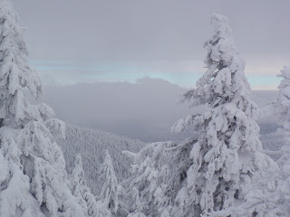
View from atop Mt Kit Carson


Ice Age Trail - Multiple Areas

Southern Kettle Moraine - State Park Headquarters

Heading west toward the Horse Riders Camp

This is a great hike.  You start off on the Ice Age Trail heading through an open field.  In the winter it can be a big expanse of white snow and during the spring, summer and fall it's full of wild flowers.  Absolutely beautiful.  And if you're lucky enough like I was this winter, I got to break trail.  Since no other human footprints were in the snow, I was able to see many of the tracks left by the natural inhabitants to this area.

You could see the field mice tracks running around on top of the snow and then where they dove under.  You could see the fox tracks on the Ice Age Trail that would go off trail when they caught the scent of the field mice.  And plenty of rabbit tracks as you got closer to the edge of the field toward the wooded area.  Nature at its best.
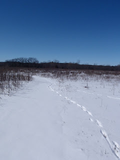
Fox Tracks on the Ice Age Trail
Following fox tracks on the Ice Age Trail
And then once you get back in the woods - peace, quiet and solitude.  Looking at the shadows of the trees on the snow, listening to the birds, eating lunch by a frozen pond.  What else could you ask for?  What a perfect place to snowshoe.  

Ice Age Trail - Southern Kettle Moraine - West from headquarters
It's Wisconsin, so for training we don't have any mountains to climb, but this was a good trail for some quick hits up and down for pushes of about 175 ft.

Southern Kettle Moraine - Ice Age Trail - Eagle Segment

Great day to get those snowshoes out and train because of the friends I had with me.  It was great getting them out snowshoeing especially since one had not done it before.  I love introducing people to the outdoors so this was a special snowshoe trip.

We had fresh snow and got to break some trail while out on the Ice Age Trail.  It was also a part of the Ice Age Trail I hadn't been on in a while so it was great to visit it again.  Another area where you get to go through some open fields where in the summer months are filled with wild flowers.  And this is Wisconsin so getting to snowshoe along the farmer's fields in the winter provides you with open views of the woods and area that Southern Kettle Moraine and these people get to call home.  Beautiful.

Ice Age Trail - Eagle Segment
Again - not a lot of elevation to gain while training, but another 135 ft gained on this day.

Northern Kettle Moraine - Ice Age Trail - Milwaukee River Segment

Probably one of the most scenic (in my opinion) parts of the Ice Age Trail in Northern Kettle Moraine.  From the New Fane trails parking lot, you'll head through the forest and then an open field for a bit.  But after crossing the road, you're in the woods.  The first section once you cross the road is full of remnants of the glaciers that went through Wisconsin.  High hills that you'll cross over and walk between provide some amazing scenery.  
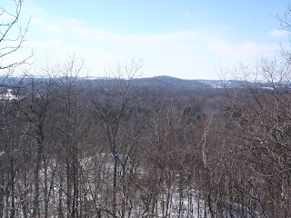
Ice Age Trail - Milwaukee River Segment
View from the Ice Age Trail - Milwaukee River Segment

I trained here by snowshoeing on one of our coldest days.  It was -4 degrees fahrenheit this day with the wind.  The second segment of this trail after crossing the next road climbs a hill and for a while follows the edge of the bluff.  From here you can see out quite a ways and even see the ski hill in Kewaskum, WI.  It really is an amazing view.  But didn't stay up here too long on this day due to the wind.  Continued on with the dogs and got back in the trees for the little protection they provide during the winter months.
Ice Age Trail -  Milwaukee River Segment
Ice Age Trail - Milwaukee River Segment

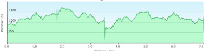
Again, not much elevation gain - maybe about 200 ft from the lowest point to the highest point, but still a good area to snowshoe in.  And again, finding peace and solitude in the woods.  

Training Continues

Those are just some of the favorite spots so far this winter where I've gone snowshoeing for training, though are not the only ones.  I hope this makes you want to go out and hike or snowshoe some of these areas.  They really are a great way to explore nature and some of the natural surroundings of the Kettle Moraine areas of Wisconsin.  Our state park system does a great job of maintaining and providing this for us to use, so get out there and use it.  And if you ever need someone to explore it with - just let me know.

Sunday, January 6, 2013

2012 - A Year Outdoors

Great Outdoors

Never realized when I titled my blog the Great Outdoors that literally I'd be spending so much time in the outdoors.  And 2012 has proven to be just a bunch of experiences enjoying life outside.  I'm so glad I have the ability and opportunities to experience what I do and look forward to doing more of it in 2013 and bringing more people along for the hike.

Mt Kilimanjaro

January and February, I trained, trained and trained some more as I got ready to tackle one of the seven summits - Mt Kilimanjaro in Tanzania, Africa.  It was quite an experience.  To not only climb 19,340 ft (5895 m), but to meet some great people, experience a different culture and throw in a safari to boot.  

Uhuru Peak - Mt Kilimanjaro

42 Nights of Camping

Yes, 42 nights - that's a lot (12% of nights in 2012).  I beat 2011 by 2 nights.  I don't intend to beat 42 in 2013.  Some experiences were great, some ok and some stressful (when you lose your phone).  The majority of the best nights in a tent came with a backpacking experience.  But also - a few camping experiences allowed me to get people out camping with me and help them (or most of them) gain an appreciation of the outdoors.  And finally I got to explore a lot more of the Driftless Area of Wisconsin.  Hiking and camping in state parks I'd never been to.  I think I now have the entire driftless area covered for state parks.

Backpacking

The first night in a tent came back in February 2012 with a snowshoe trip up in the Kettle Crest Range in northern Washington.  Hanging out up in the mountains overnight in the winter was incredible.  Not only was I the first one to sign in to the log book on Wapaloosie Mountain for 2012, but from the top we could also see into Canada.  

View from camp in the Kettle Range Mountains of Washington 
Other memorable backpacking experiences of 2012:
  • Yellow River State Forest in Iowa - the hilly area of Iowa.  Very pretty, quiet.  May 2012
  • Superior Trail in northern Minnesota - what a beautiful area.  Need to get back here again.  Labor Day weekend.
  • Kokanee Glacier National Park in British Columbia, Canada.  Beautiful and quiet in mid-September.  But sad to see the glacier is receding.  Hopefully they get a lot of snow pack this year to help build it back up.

Other Great Experiences

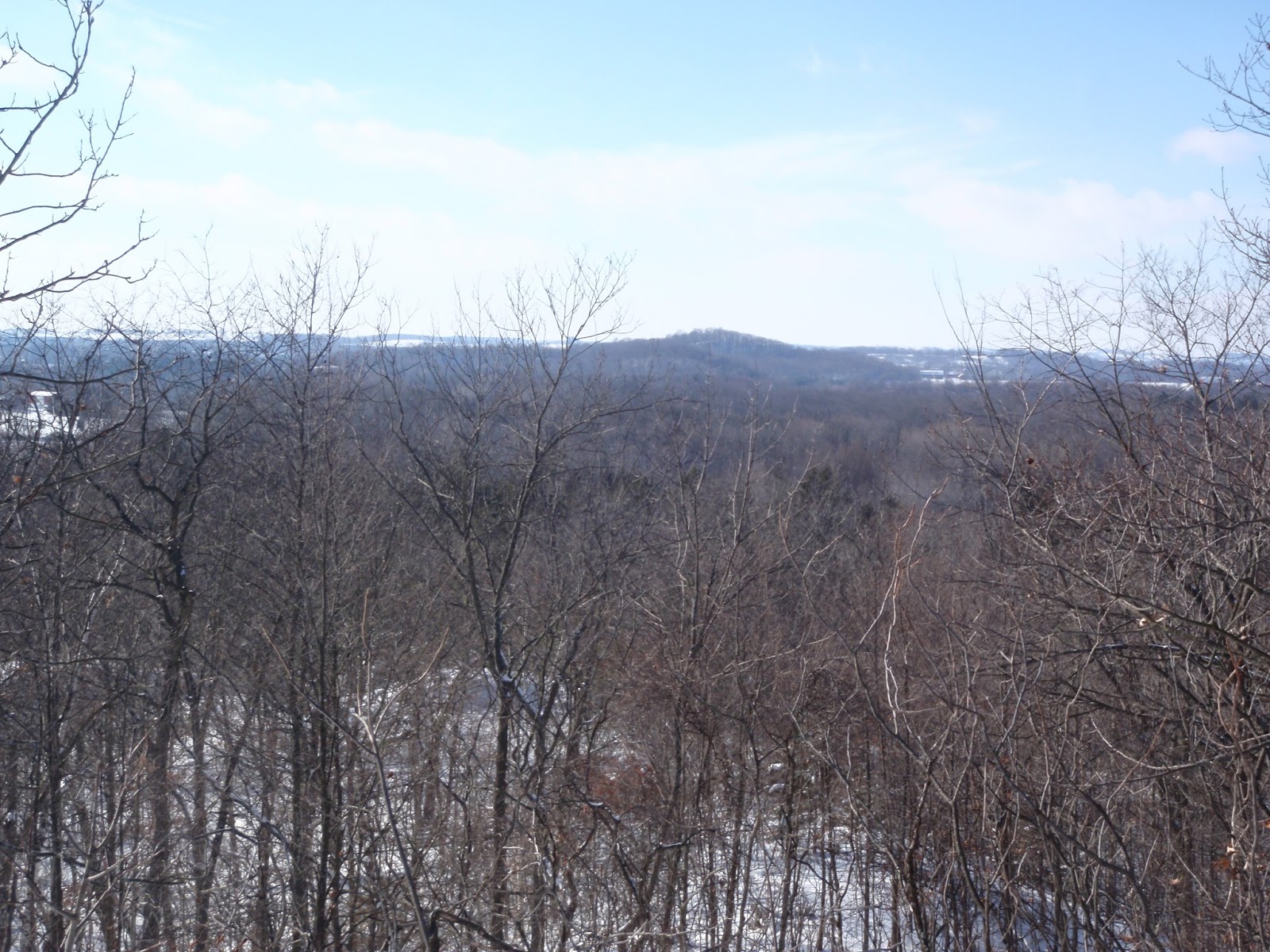
View from Mt Kit Carson, Spokane, WA
  • Timms Hill - Wisconsin's highest point.  Not quite the same as Kilimanjaro, but still another one of the USA's 50 highest points picked off.  (1500+ ft)
  • Christmas in Washington - got to visit my brother in Newman Lake and take in some great hikes and snowshoeing in the area.  Finally got to go to Mt Spokane State Park and get to the top of Mt Kit Carson via snowshoe.  (And had the peak to myself)
  • Dogs - Jasmine and Wailea made it another year - ableit a few surgeries to fix a torn ACL (Wailea) and remove a ~7 lb tumor and her spleen (Jasmine).  The dogs managed to get in 33 nights in a tent and traveled to 6 states.  Hopefully both remain healthy enough to continue in 2013.  

Backpacker Magazine, Mt Whitney and 2013

Mid-year 2012 I found out Backpacker Magazine was offering up to its readers an opportunity to climb Mt Whitney with their editor, Jon Dorn.  So in July, I wrote and submitted an essay, wrote my "I Want to Climb Mt Whitney" blog post and had wonderful friends support me via posts to it to try and get to selected to join Backpacker in their Mt Whitney summit attempt.  

After what seemed like forever, I got a response.  I was lucky enough to be selected to join Backpacker Magazine to climb Mt Whitney and support a great organization - Big City Mountaineers via Summit for Someone.  

Which brings me to 2013.  This climb is in April 2013, but I've started training and am really looking forward to this opportunity.  I'll get to the highest point in the contiguous 48 states (and highest point in CA), experience mountaineering, meet new people and make new friends, help some under-privileged youth get a great experience as well and finally get to the Sierra Nevada's.  I can't wait.  I'm sure this will be one of my highlights for 2013.

Special Thanks

Thank you to everyone who has joined me and supported me in all the adventures of 2012.  And if you didn't join me - feel free to join me in 2013.