Sunday, October 6, 2013

Lessons Learned from My Dogs

Watching my dogs today as I was getting things organized so we could go for a car ride and then go for a hike to look at fall colors, I started to think about what little things like this mean to them.

A car ride means they get to go some where.  A hike means they get to explore the woods and wilderness; roam free and chase squirrels.  And the car ride home typically means we're going for ice cream.

Simple things.  Things that do not take a lot of effort.  Things that mean time spent doing what you love.  And time spent with what for me is my family that has four legs.

As my dogs continue to get older, I hope I can continue to give them the simple things in life that they love so much.  Because the simple things they love so much are a reminder to me on how to lead a simpler life.  Enjoy life at a relaxed pace.

Jasmine and Wailea hiking on the Ice Age Trail - Milwaukee River Segment - Northern Kettle Moraine State Forest
Jasmine and Wailea hiking on the Ice Age Trail


Wednesday, September 25, 2013

Pushing My Own Limits & Finding My Adrenaline Rush

Vacations and Comfort Zones

Vacations to me are not meant to be something that is about comfort.  Vacations to me are all about escaping the everyday comforts that we have.  Vacations are for pushing your limits, going outside your comfort zone and getting an adrenaline rush.  For me - it's also a way to grow personally and expand my world beyond the every day.

My most recent vacation took me to the Eagle Cap Wilderness in Northeast Oregon and to Goat Rocks Wilderness in the Cascades of Washington.  While both backpacking locations initially didn't appear to provide anything really out of my comfort zones, Goat Rocks Wilderness proved me wrong.

Goat Rocks Wilderness, Pacific Crest Trail & Leading Blindly into the Clouds

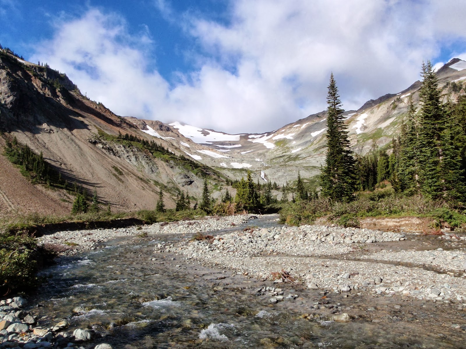
The trip to Goat Rocks Wilderness started out with taking a route up that connected us to the Pacific Crest Trail and backpacking into the Cispus Basin.  Cispus Basin was beautiful with waterfalls and wild flowers every where.  What a peaceful place to set up camp for the night.

Camp at the Cispus Basin on the Pacific Crest Trail - Goat Rocks Wilderness - Cascades
Camp at the Cispus Basin on the Pacific Crest Trail
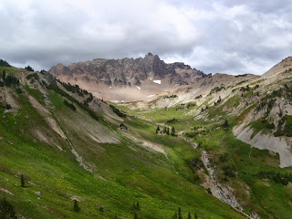
Cispus Basin - Pacific Crest Trail - Goat Rocks Wilderness - Cascades
What we didn't know on day one is that the forecast we had seen when we last had cell service had probably changed for the following day.  A few hours after the sunset and after settling in the tent to listen to waterfalls in the basin, rain moved in.  Light showers coming in off the Pacific Coast fell off and on all night.  By early morning the rain had stopped and we got up to make breakfast, pack up and get ready to go.  We knew we had a long hike in front of us to climb up, cross the ridgeline and then drop back down to where we were going to camp in McCall Basin on the opposite side of the mountain ridge.  

Shortly after leaving camp we started hearing thunder in the distance.  As we continued to hike up toward the trail that would take us up to the ridgeline and over we started to get a good glimpse of what was coming at us.

View from the Pacific Crest Trail of the storm rolling in to the Cascades

We finally took a quick break in one of the last grove of trees to put on our full suit of rain gear and cover our packs.  Once we realized the rain wasn't going to stop anytime soon and that there was no sign of lightning we decided to head out and brave the rain.  What we didn't expect was what we ended up getting ourselves in to.  

The weather continued to get worse as we hit the higher elevations.  The winds picked up, the clouds rolled in and visibility went down to almost nothing.  


Crossing the snowfield on the Pacific Crest Trail in Goat Rocks Wilderness
My brother crossing the snowfield in the fog - visibility was low.

As we continued up and hit the ridgeline with steep slopes on either side of us, the wind picked up to what we were guessing was hurricane force speed.  Just standing up at times was difficult and with the fog so thick you couldn't see the trail in front of you, this day definitely pushed my limits.  

Pacific Crest Trail along the ridgeline at Goat Rocks Wilderness.
Pacific Crest Trail along the ridgeline at Goat Rocks Wilderness.  Photo credit: Ken Vanden Heuvel
But what was most amazing up there is when the wind would push the cloud over the ridge and you'd actually get a few seconds to glance down before the next one would blow in - the brief views we had were amazing.  In the end after hiking the few miles of this ridgeline for a couple of hours and some breaks to take deep breaths to calm my nerves, we made it across in one piece.  The only incident we had was watching the wind take hold of the rain cover from my pack and blowing it out to who knows where.  

The other surprising thing that day - for as busy as the Pacific Crest Trail can be with the hikers nearing the end of their journey, we saw no one else on the ridgeline this day.  We did run into one thru hiker later that day as we headed down to McCall Basin who crossed behind us.  We figure we were probably the only 3 fools who decided to cross that day.  It was definitely a nasty day and probably not the smartest move we've ever made in our lives, but it sure did provide for an adrenaline rush and great memories that I'll never forget.

Once over we headed down to the McCall Basin to camp and dealt with the rain for the remainder of the day and night.  The clouds finally broke sometime around morning.  We spent most of the next day exploring the McCall Basin with the elk that were in the area.  No other humans around.  This made up for what we went through the day before.  

McCall Basin in Goat Rocks Wilderness - Cascades
After exploring the McCall Basin we headed back out and back up toward the pass and ridgeline - yes, we had to go back over the next day.  We camped right below the climb back up to the ridgeline and right in view of Mt Rainier.  We had great views for sunset and sunrise.

Finally the next day we hiked back up and over the ridgeline with the sun out and winds that you could stand up in.  It was an amazing hike back seeing all the glaciers and valleys below.  I was glad we were able to head back over and see what we couldn't see the first time over.

View of Mt Rainier from the Pacific Crest Trail and the trail along the ridgeline
Our last stop for this trip was a night at Goat Lake.  The most amazing thing, it was August 31, 2013 and Goat Lake still had ice partially covering it.  Beautiful lake, but a little too crowded with it being Labor Day weekend.  Thankfully we found a campsite that had a great view of Mt Adams and the valley below.  And for a place call Goat Rocks Wilderness, this was the only place I saw mountain goats.  How fitting.

A view from the Pacific Crest Trail of Goat Lake
Overall this trip was amazing and probably more amazing because I pushed my limits, went outside of my comfort zone and crossed that ridgeline.  And if I had to do it all over again, I'd be right up there taking on the hurricane force winds and crossing that ridgeline.  

Hope your vacations push your limits and take you outside your comfort zones.  Make it an epic vacation and something that you'll always remember.

And as with most blog posts, I like to end with a John Muir quote - this one seems perfect as I received much more than I seeked on this journey.

In every walk with nature one receives far more than he seeks.  John Muir


Wednesday, July 31, 2013

The Story of Trees

Hiking in the Forest

When I'm hiking in the forest I notice a lot of things.  Because of the peaceful surroundings I'm able to take in the sounds, the smell and the environment.  I think one of the things I enjoy most is the environment.   When left alone, a forest can grow, mature, die and start over again.  

Over the last couple of years, I've really noticed this more and more.  And I'm always amazed when I see old trees surrounded by much younger trees.  It always makes me wonder what is their story.

The Majesty of Trees

I love to photograph old / big trees.  When I do - I always stop and take in their structure, their location and their surroundings.  Many times if you look around the tree - most trees around it are younger growth trees.  I then often wonder, how did this one tree or this group of trees survive?  What was here before that only this tree is left?  Did someone plant this tree?  How old is this tree?

Old growth tree at Long Lake Campground - Northern Kettle Moraine State Forest
Old growth tree - Long Lake Campground
Photographing old trees in just the right light can always make it look powerful and strong.  And then makes me wonder will the other trees around ever get the chance to get that old and big?  Or will someone, some day come along and cut it down.

View from the Ice Age Trail @ Holy Hill
The view from the Ice Age Trail @ Holy Hill

Maybe a little philosophical - but old trees are like the heart and soul of what holds a forest together.  Without them and their presence all we'd have are young trees and forests.  The magic would be gone.


Saturday, June 22, 2013

Door County Wilderness - Off the Beaten Path

Traveling to one of Wisconsin's most popular locations - Door County, one doesn't expect to find area's protected as Wilderness.  But that's exactly what you'll find when you head to Newport State Park on the tip of Door County.

Newport State Park

I am somewhat fond of this state park because of it's Wilderness declaration (it is the only state park in Wisconsin that is designated as a wilderness park), but also because this is where I had my first backpacking experience back on May 1st 2010.  I've camped since I was 6 months old, stayed on hike in campsites, but never took my pack and gear and did a backpacking experience.  And when I finally did it, I didn't just grab my gear, but also enough gear for two dogs.  And in early May, in Door County, and directly on Lake Michigan.  Yes, it was cold as I remember.

Backpacking at Newport State Park, Door County, WI
Backpacking at Newport State Park
Newport State Park does not allow campers.  All 16 campsites in this park are backpack sites.  With the craziness of Door County and all the tourists, you can escape that easily at this park.  It's one of the reasons I make a point to take at least one trip each year back up here.  Very rarely when I'm hiking the trails do I run into another person.  (There's about 30 miles of trails in the park.)  And so far since 2010, I've made another four trips.  Each time, experiencing a different time of the year.  Spring, Summer months, Fall - and it doesn't matter when you go, it's always quiet and beautiful.  

Newport State Park, Door County, WI
Newport Beach State Park - View from site to Lake Michigan
One of the things I really like about this park is how you can go from a beach shoreline to a rugged shoreline.  All within a short hike.  And with the wilderness designation, you can see and experience all types of wildlife (be careful of the porcupines).  

Rocky Ledges, Newport State Park, Door County, WI
Rocky ledges @ Newport State Park, Door County, WI
And because of the lack of people - I think it's one of my dogs favorite parks.  They run off leash and get to swim in Lake Michigan.  It's so fun to watch them run and chase the waves on Lake Michigan.  And then after dinner, they're pretty much done for the day.  


Then once they're done - I can relax and watch the moon rise over Lake Michigan.  Eventually turning in for what is typically the best sleep I get - outdoors and in a tent.  Sun, fresh air, hiking and peace and quiet in the wilderness.  What else can one ask for?  

Moon rising over Lake Michigan at Newport State Park, Door County, WI
Moon rising over Lake Michigan @ Newport State Park

“I only went out for a walk and finally concluded to stay out till sundown, for going out, I found, was really going in.”   John Muir

Sunday, May 19, 2013

Ice Age Trail - Blue Spring Lake Segment Field Editor


Documenting the Ice Age Trail

This year I volunteered to be a Field Editor to help with the preparation of the 2014 Ice Age Trail Guidebook.  Volunteers select a segment of the 1,000 mile Ice Age Trail, take previous notes and maps into the field with them to review and do research on the segment they have.  In the end they'll add comments, updates, interesting facts and photos of the segment they're editing.  It's a really great opportunity for those of us that love the Ice Age Trail to slow it down and experience it in a different way.


Blue Spring Lake Segment

Lucky for me I was able to grab the Blue Spring Lake Segment to edit in the Southern Kettle Moraine State Forest section that included the one last piece of Ice Age Trail I hadn't yet hiked in the Southern Kettle area.  I had hiked from both ends of it previously, but had never hiked the middle piece of the trail I was going to edit.  So this turned out perfect for me.


Ice Age Trail - Blue Spring Lake Trail Segment
This section of the trail covers just over 7 miles of trail one way.  In order to completely and accurately take notes and compare to previous documentation, I decided to split it in two hikes and take my time.  Plus it allowed me to bring my dogs along for the hikes.

Day 1 - Hiking Young Rd to Horseriders Campground

On a perfect spring day with cooler temperatures, the dogs and I were off to start our documenting and editing of the Blue Spring Lake Segment of the Ice Age Trail and hit up the one section of the Ice Age Trail in Southern Kettle Moraine State Forest I hadn't hiked yet.  We drove to the western edge of the segment and hiked the 4.2 miles of trail that this section covered (1 way - 8.4 miles round trip).  This section of the trail includes lots of hills, hardwood forest and some pretty great points of interest.

Ice Age Trail - Blue Spring Lake Segment Elevation Profile
It basically starts out immediately with a short hike from the road to a quick 100 foot incline up a few switchbacks to reach the Bald Bluff Scenic Overlook and Natural area.  The Bald Bluff overlook provides some great views of the area surrounding it.

View from Bald Bluff Scenic Overlook & Natural Area

After heading back down the other side of the bluff, you'll walk another 1.5 miles or so to get to the next point of interest, the Stone Elephant.  The Stone Elephant is large granite erratic left over from when the glaciers moved through Wisconsin.  History has it that the Prairie Potawatomi Indians used to visit this place often.

Personally, I'm still trying to see the "elephant" in this rock because after visiting the Stone Elephant twice now and viewing it from all angles, I can only really see a whale.  Guess I'll have to go back a third time.


The Stone Elephant on the Ice Age Trail
The Stone Elephant
The Stone Elephant on the Ice Age Trail
The Stone Elephant
The remainder of the hike on day 1 was a beautiful, peaceful walk through old oak forests and some pine forests.  The old oak forests included a lot of old black oak trees and in early spring, these trees were still bare or just starting to get their leaves.  It made them look so dark and almost intimidating like they were reaching out to grab you, but still regal and towering over the forest.

Old oak forest - Ice Age Trail - Blue Spring Lake Segment

After taking a short break at the Horseriders Campground for a quick drink and snack, the dogs and I turned around and walked the 4.2 miles back to the car.  Overall - this section of the trail in early spring is a winner.  Trees are growing their leaves, spring flowers are starting to bloom and the dogs and I basically had the first almost 4 miles of the trail to ourselves and on the return trip - the entire trail to ourselves until we hit Bald Bluff.

Day 2 - Hiking Horseriders Campground to Emma Carlin Trailhead

The second half of the Ice Age Trail - Blue Spring Lake Segment that I covered from the Horseriders Camp to Emma Carlin Trailhead was about 3.3 miles in length one way.  Unlike the first section we hiked that included the Bald Bluff and Stone Elephant, this section didn't include any points of interest like that.  This section instead was mostly hardwood forest with more glacial terrain of hills.  

Blue Spring Lake Segment from Horseriders to Emma Carlin TH - Elevation Profile
Ice Age Trail - Blue Spring Lake Segment - Horseriders to Emma Carlin Elevation Profile

I've done this section twice before, once during a hot, wet summer and just this last winter via snowshoe.  I really like this section of trail.  In spring you'll see plenty of Mayapples (or umbrella plants).  These plants will appear and unfurl before the trees get their leaves, leaving the forest floor full of these beautiful, bright spring plants.  In the winter, this section is great for snowshoeing and getting great views of the valley floor.  The only downfall for this section is the standing water.  It's a breeding bed for mosquitoes, so if it's a hot, wet summer - bring plenty of bug spray or pay the consequences and plan to be a blood donor to mosquitoes.  

Mayapples on the Ice Age Trail - Blue Spring Lake Segment
Mayapples on the Ice Age Trail
Winter on the trail - Ice Age Trail - Blue Spring Lake Segment

Now that I've documented, edited, photographed and researched it, I just need to finish pulling it all together and getting my section - the Blue Spring Lake Segment of the Ice Age Trail - done and off.  So in 2014 - watch for the new Ice Age Trail Guidebook.  And when you pick up your copy - think of me when you're reviewing the Blue Spring Segment information.

And if you want to experience it, let me know, I'd be glad to take you out on the trail and show you some of points of interest and cool little areas I found as I took my time really getting a chance to take it all and know this area unlike I knew it before.


Additional Posts -
Hiking in the First Snowfall - Northern Kettle Moraine
Winter Hiking on the Ice Age Trail - Southern Kettle Moraine & incidents with hunters


Friday, April 19, 2013

Mt Whitney - The Journey

Applying to Join Backpacker Magazine

It's hard to believe it's been just over 9 months already since I applied to join Backpacker Magazine and their editor Jonathan Dorn to climb Mt Whitney, the highest point in the "lower" 48 states.  Knowing it would be an incredible journey if I was picked not only because would it provide me a chance to combine skills I've gained from various other climbing and hiking I've done into an actual mountaineering experience, but also because it was in conjunction with Summit For Someone (SFS).  I've seen the ads in Backpacker Magazine for years, checked out their website for climbs and have contemplated going on a journey with them because of what SFS stands for and how it supports and benefits Big City Mountaineers.

And with the help of a lot of friends who showed their support by posting comments on my "I Want to Climb Mt Whitney" blog post about why I should be selected, I found out in October 2012 I was selected.

Getting Selected to Climb Mt Whitney

I think the day I found out I was selected to go along on this journey I went through a lot of emotions.

  • Excitement - wow, I was going to get to do this.
  • Worry - do I have a pet sitter?  My parents will be in Hawaii in April.
  • Distress - What did I get myself into?  
    • I now have to raise $4,000 
    • I have to train for another climb (having just done Mt Kilimanjaro earlier in 2012)
But again - all of the things I was worried about fell in place.  My parents arrive back the day before I leave - pets will be taken care of.  Training started immediately in October and I'm feeling pretty good and strong. And again, incredible friends reached out to me when I put out the call that I was going to climb Mt Whitney and helped me to raise the money for this great cause.

And Now It's Time to Climb Mt Whitney

  • The training is done.  
  • The gear not already owned is purchased.  
  • Test packing all this gear in the pack is done.
  • Travel from Las Vegas to Lone Pine is coordinated.
  • Mentally, I am prepared!
And most importantly - team Whitney Four-Teeners is psyched about what we're doing, the reason we're doing it and having the opportunity to meet and make some new lifelong friends.

And as John Muir said  -  "The Mountains are Calling and I Must Go."  

The time has come, the journey begins and a summit is within our near future.  Mt Whitney - here I come!

Monday, April 8, 2013

Put Your Boots On - Go For a Hike

Over the years I've found that my closet has become crowded with multiple pairs of hiking boots.  Unlike most females I know who have a closet full of nice, fancy shoes, I have a closet full of hiking boots, trail runners and other outdoor related footwear.

What does this say about me?  To me it says I'm a person who likes to be outdoors.  And I'm glad to be that person.

Enjoying Nature while backpacking in the Bridger Teton National Forest
Every time I look in my closet I see potential.  Wearing hiking boots means I'm going to be outside, taking a hike, spending time with my dogs, family and/or friends.  It means seeing nature, watching the changing seasons, listening to the birds and just breathing in the deep smells of mother earth.  It means I'm relaxing and letting nature heal my soul.  

So go put your boots on and go for a hike.  And enjoy the Healing Powers of Nature.

"In every walk with nature one receives far more than he seeks"  John Muir